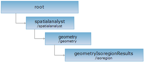
<geometry_uri>/isoregion[.<format>]
Extracts the isoregion based on the point array (temporarily not supported).
Supported Methods:
Supported output formats: rjson, json, html, xml.
Implement the HTTP request on the following URI, where supermapiserver is the server name, with rjson being the output format.
http://supermapiserver:8090/iserver/services/spatialanalyst-sample/restjsr/spatialanalyst/geometry/isoregion.rjson
Returns a form for the POST request.
creates an isoregion analysis result resource, equivalent to the isoregion extraction based on the point array.
Parameters in the URI:
| Name | Type | Description |
| asynchronousReturn | boolean | Whether to employ asynchronous operation or not. If true, returns the URI of the new resource immediately after the client submits the request (returnContent setting doesn't work); if false, the server returns the description or the URI of the new resource URI according to the returnContent settings after analysis. The default is false. |
| returnContent | boolean | Returns the description or the URI of the new resource. If true, returns the description for the analysis result. If false, returns the URI. The default is false. |
The parameters in request body are as follows:
| Name | Type | Description |
| points |
Point2D[] |
The point set needed to extract isoregions. |
| zValues | double[] | The field name for the extracting operation. When extracting the isoregions, the value in this field is used for interpolating the point data in the record set. The interpolation results a raster dataset (an intermediate result) based on which the isolines are extracted for finally creating the isoregions. |
| extractParameter | ExtractParameter | Parameters for extraction. |
| resultSetting | DataReturnOption | The extraction result setting. |
| resolution | double |
The resolution of the middle raster dataset, represent the actual distance represented by a cell. The value range: Can not greater than the length of the short side of the dataset extent to analysis. Can not less than the one ten-thousandth of the long side of the data extent. The recommended value: the one five hundredth of the extent of the sampling point. |
| clipRegion | Geometry | [Optional parameter] The clip region object. Use null to replace this parameter is do not need to perform clip operation. |
| expectedZValues | double[] | [Optional parameter] The expected analysis result Z value collection. |
Normal response code(s): 201. The response parameters are as follows:
| Field | Type | Description |
|
succeed |
boolean | Whether the query is successful. |
| newResourceID | String | The ID for the analysis result resource. |
| postResultType | PostResultType |
The result type fo the POST request. |
| newResourceLocation | String | The URI of the newly created resource. |
Implement the POST request on http://supermapiserver:8090/iserver/services/spatialanalyst-sample/restjsr/spatialanalyst/geometry/isoregion.rjson and the parameters are as follows:
The response in rjson format is as follows:
{
"succeed": true,
"newResourceID": "1",
"postResultType": "CreateChild",
"newResourceLocation": "http://supermapiserver:8090/iserver/services/spatialanalyst-sample/restjsr/spatialanalyst/geometry/isoregion/1"
}
Implementing the GET request on http://supermapiserver:8090/iserver/services/spatialanalyst-sample/restjsr/spatialanalyst/geometry/isoregion/1 can get the result of the isoline extraction. Please see geometryIsoregionResult.
Asks for the response identical to the one that would correspond to a GET request, but without the response body. This is useful for retrieving meta-information written in response headers, without having to transport the entire content. The meta-information includes the media-type, content-encoding, transfer-encoding, content-length, etc.
The HEAD request helps check the existence of the geometryIsoregionResults resource and whether it can be accessed by the client. By implementing the HEAD request on the URI, with .<format> appended to the end, we can quickly get to know whether geometryIsoregionResults resource supports the representation in <format> or not.